Asmant el-Kharab
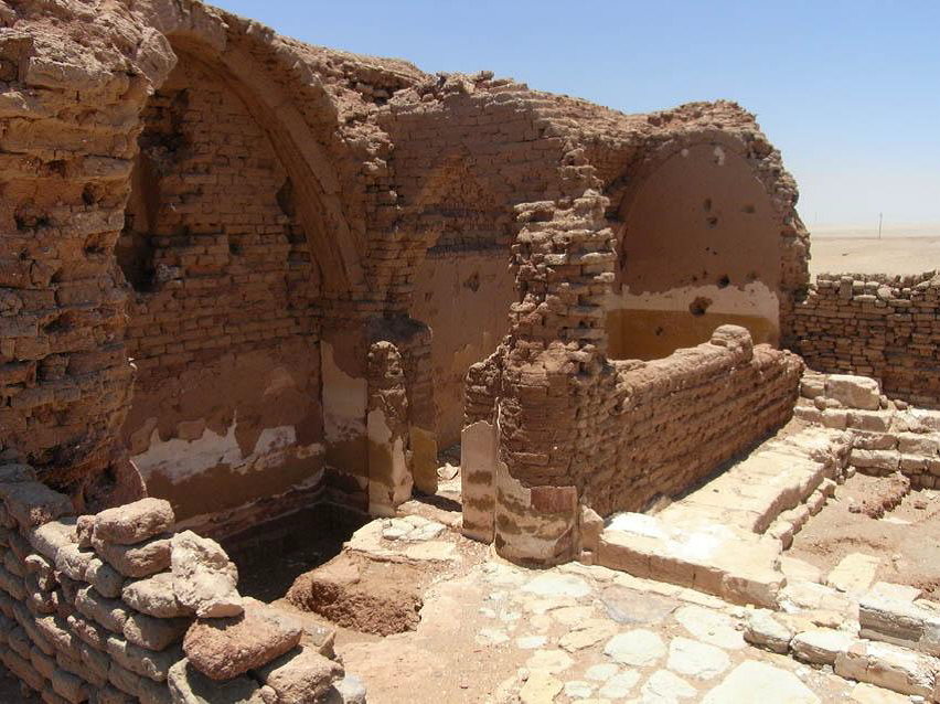
Asmant el-Kharab (Kellis)was one of the largest settlements in the Dakhla oasis in the Roman period, but some remains suggest that the site was already inhabited in Ptolemaic times. The archaeological site is located on the paved road between Mut and Balat, 2 km to the east of the modern village of Ismant (or Smint). Originally people here were devoted to the gods of the Egyptian and Roman pantheons, but by the 4th century the whole population was probably Christian. On the site ofAsmant el-Kharab there are remains of numerous private houses, large administrative complexes, farmhouses, baths, churches and aqueducts, most of them in a good state of preservation. Located southwest of the main community there are two temples standing side by side. The Temple of Tutu is one of the oldest buildings on the site (it dates to the 1st century AD); it has scenes painted during the second and third centuries. The second temple, smaller than the first one, has a sandstone doorway. Three mudbrick churches have been found so far at Kellis. They are built of mudbrick with white plastered walls and they have also graffiti. In one of the churches a cache of bronze Roman coins with the head of Costantine the Great and other Roman emperors was found. Textual material such as official documents and letters on papyri have been discovered on the site. Among the most important materials found on the site there are three wooden codices, discovered in the corner of a room of one of the houses of the ancient settlement. The first codex consists of nine wooden boards where three literary pieces are written; they form a treatise and political instructions by Isocrates. The second codex consists of one board written in Greek and is a contract for the selling of a house in Kellis. Thanks to this codex archaeologists discovered the ancient name of the settlement. The third codex consists of eight boards containing four years of farming accounts. Also private letters written in Coptic were found on the site (CISS Inventory 2010; Vivian 1990).
Site coordinates: N 25 31 422 E 29 04 406