New Valley in a nutshell
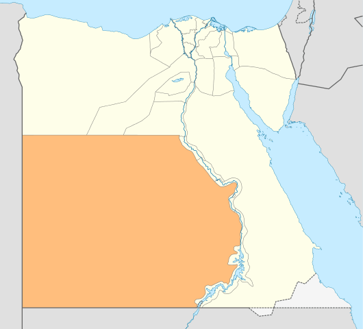
New Valley Governorate or El Wadi El Gedid Governorate is one of the governorates of Egypt. It is located in the south western part of the country, in Egypt's Western Desert (part of the Sahara Desert), between the Nile, northern Sudan, and south eastern Libya. It shares the borders with the governorates of El Menia, Giza and Marsa Matrooh on the north and Assiut, Suhag, Qena and Aswan on the east.
The New Valley Governorate is considered the biggest governorate in the country in terms of area, which amounts to approximately 440098 km2, representing approximately 43.6% of the total area of the country.
The main oases of the Governorate (Kharga, Dakhla and Farafra) are located in depressions fallen below the average surface of the desert. These depressions are the result of the combined action of wind, tectonics and water during the Pliocene epoch. They are surrounded totally or in part by a cliff called escarpment or scarp, the top of which is at the level of the normal desert floor. Being the depressions near or at sea level, subterranean water is easily accessible thanks to natural springs or by drilling wells, therefore settlements have been built there since ancient times (Vivian 1990).
The governorate is divided up administratively into 5 markazs which comprise 5 cities, 37 local units and 164 villages. The markazs are: Kharga, Dakhla Farafra, Balat and Baris. Urban markazs are set up according to water resources and availability of arable soil in the territory. Furthermore, roads and transportation is considered the main factor for the urban activation and development of the markazs and their sustainability.
New Valley governorate embraces several tourist attractions, most important of which are: Hibis Temple that dates back to 550 BC and the Necropolis of El-Bagawat which dates back to the second and third century. The governorate also enjoys curative tourism destinations since it has got hot and sulphuric springs, as well as a pollution-free dry climate. More information about the archaeological and natural tourist attractions in the New Valley Governorate can be found in Tourism.
The Governorate's national day
3rd October commemorating the arrival of reconstruction troops to the area in 1954.
Emblem
A palm tree, which the governorate is famous for, appears behind a monumental gate. Date is the major crop of the governorate.
New Valley population
The population reached 243,750 people in May 2018 and the population density for the total area is 1 person per 2 km2.
New Valley Climate
The New Valley climate is dry desert climate. The most important factors may be exposed as follows:
- Rainfall is almost scarce throughout the year, not exceeding 4 mm/year;
- Average annual temperature is 23 degree Celsius;
- Average relative annual humidity is 35.5%;
- Average annual wind speed is 6 km/hour.
Natural protectorates
The New Valley Governorate is rich in natural components, thanks to the governorate‘s location in a desert area which enjoys attractive geological features that contributed in the intensity of the biological diversity in the governorate. The New Valley Governorate has two natural protectorates as follows:
White Desert Protectorate
It is a desert area located on the northern part of Farafra Oasis, occupying an area of 3010 km2. It was declared as a natural protectorate through the decree of the Prime Minister No. 1220 of year 2002. The area includes a plant cover and a number of land animals threatened with extinction such as the white gazelle and bighorn. Furthermore, the area attracts many visitors thanks to the fascinating landscape of the White Desert, with sand dunes and the geological formations of the shining white lime stones.
Big Gulf Protectorate
It is situated over an area of 48.5 km2, consisting of Nubian sandy rocks, old volcanic vents, mountain areas, deep narrow valleys, chains of the Great Sand sea, extending longitudinally from the north to the south. The Big Gulf was declared as a natural protectorate according to the decree of the Prime Minister No.10 of year 2007. The area contains the rare glass silica, which may be exploited economically. Furthermore, the area is full of rare types of animals and plants, in addition to the presence of significant tourism monuments such as the remains of the Stone Age in the Green Land Valley, the Yacht Valley, and engravings on the stones in the Soda Valley.
Oases
Kharga Oasis
Kharga, the capital of the New Valley Governorate, is situated 191 km east of Dakhla and 244 km almost due south of the Nile Valley city of Asyut. Kharga oasis is rich of history and traditions. There are many fortresses of the Roman Period as well as Pharaonic temples. The desert is rich of prehistoric rock inscriptions and there are also ruins of Coptic churches, cemeteries and ancient rural communities. More information about the archaeological and natural tourist attractions in Kharga oasis and in the New Valley Governorate can be found in Tourism.
Geography and landscape
Sand dunes are the dominant features of the Kharga oasis. They are mostly barchans dunes falling into three belts: the northern group accumulating around Gebel el Tarif and Gebel el Sheikh; the middle belt east of Gebel el Teir, Gebel el Tarwan, Gebel Nadura, and the northern slopes of Gebel el Qorn; and the eastern belt from the scarp opposite Gebel Yabsa south to the Baris plain. The most massive dune formation is the first one. The sandstone, which composes most of the depression floor, is 700 meters (2,240 feet) thick. Underground water gushes forth from the depression floor through natural springs or drilled wells (Vivian 1990).
History
While there is evidence that Palaeolithic man inhabited many of the passes leading into the oasis, living along the scarp and desert floor, little has been found about settlements during the Old Kingdom. More information is available about Kharga during the New Kingdom.
Kharga was an important oasis throughout Egyptian history, being a major part of the trade route to the Sudan and other parts of Africa. In the Old Kingdom the Governor of Aswan, Harkhuf, journeyed to the land of Yam taking the oasis route, probably passing through Kharga, to bring back valuable trade goods and a gift for his young king, Pepi: a dancing pygmy.
Kharga was also used as a way of bypassing the Nile Valley during the Second Intermediate Period when the Nubian kingdom of Kush and the Hyksos allied against the Thebans. In more recent history, Kharga was connected to the Nile Valley by routes originating at various cities there. The most important being the Darb al-Arbain, originating in Asyut, which used Kharga as a north-south corridor leading to the Sudan. Other routes come from the area of Esna, Abydos, Girga, and possibly from Tima, Tahta, Sohag, Farshut, and Rizakat (Ball 1900: 19-20).
During Roman times (30 B.C.-33 A.D.) all New Valley oases enjoyed their greatest prosperity. Kahrga was well protected by the Romans; temples were erected in strategic areas, new wells were dug and fortresses had been built.
During the Christian Era (322-642) Christians were banished to Kharga and the other New Valley oases. Banishment to the oases was a punishment that had existed since pharaonic times. By 390 Kharga, together with Dakhla, was completely Christian. Several monasteries were established, the old temples and forts were converted into churches and hermitages built within mountains. They are among the earliest known Christian religious buildings in Egypt.
The first evidence of Islam in Kharga dates from the seventh century. Kharga was a key stopping point for caravans of hajj pilgrims coming from other parts of North and West Africa, en route to Mecca. These routes made Kharga accessible to large, well-organised caravans, but not to solitary travellers, who could gain access to Kharga oasis (as well as other oases) only thanks to the railway and motorized vehicles.
Finally, Kharga was under the British Occupation since 1882 to 1954. During this period the oasis became a tourist attraction, with trains running twice a week and accommodations at the Kara Resthouse which offered tents and supplies for desert excursions (Vivian 1990).
Dakhla Oasis
Located 295 km south of Farafra and 191 km west of Kharga, Dakhla can be accessed via the paved road through the New Valley oases. The oasis is the greenest one in the New Valley and with its 16 villages is also the most populated one. While Kharga is the administration center of New Valley, Dakhla is the breadbasket, with fields and orchards lush with produce. Dakhla is well-known by tourists for its marvellous landscape, with pink cliffs and large sand dunes in contrast with the lush greenery of its orchards, and its Islamic towns (such as the capital Mut and Qasr Dakhla). Dakhla has hundreds of natural springs and deep wells. More information about the archaeological and natural tourist attractions in Dakhla oasis and in the New Valley Governorate can be found in Tourism.
Geography and landscape
The scarp surrounding the depression runs for 200 kilometres and is 300 to 400 meters high. The escarpment, which is eroding in a northerly direction, helps to protect the depression from the harsh winds, allowing for a rich agricultural development in the oasis.
The only mountain in the depression is Gebel Edmonstone, 17 kilometres (10.6 miles) west-south-west of Qasr. As in all the oases, water is the key ingredient in Dakhla. Deep drilled wells are characteristic of this depression. At the turn of the century there were 420 ancient wells, known by the natives as Ain Romani, and 162 modern wells. Golden coloured barchan sand dunes are situated along the edges of the depression (Vivian 1990).
History
Recent discoveries tells us that Dakhla Oasis has been populated for over 10,000 years. It is likely that during the Old Kingdom Dakhla Oasis had a direct link to the Nile Valley via the Darb el Tawil and was not dependent on the route through Kharga Oasis. In fact, evidence suggests that Dakhla may have been much more important to the Nile Valley pharaohs than Kharga. During the New Kingdom Mut became the capital of Dakhla Oasis.
Like all the oases in the Western Desert, Dakhla was very populated during Roman times (30 B.C.-323 A.D.). Unlike Kharga, where dozens of Roman fortresses have been excavated, only a few ruined fortresses have been found in Dakhla.
When the Christians (323-642) came to Daklha, they occupied some Roman sites; in fact, there are ruins of Coptic churches and communities.
It was during the Classical Islamic Era (641-1798) that fortified towns were constructed in places selected for their natural defensive positions (such as hills or cliffs). In villages like Mut, Qalamun, Qasr and Balat it is still possible to view the original buildings of that period.
During the British Occupation (1882-1954) the road
from Dakhla was open to motorcars, the journey taking nine hours (Vivian 1990).
Farafra Oasis
It is the most isolated oasis in the Western Desert and also the closest one to the White Desert, steadily growing as a main tourist attraction that draws visitors to Egypt. The depression of Farafra is long and narrow; the main road in Farafra hugs the northwest escarpment leaving the rest of this large depression uninhabited, a true wilderness. The south has no end, with places barely explored by human beings, and misjudgement in such a place can lead to disaster even for a professional traveller (Vivian 1990). In Farafra Oasis there are numerous springs and wells popular for swimming and relaxing(our-egypt.com 2012). The area is also host to ancient tools, tombs, carvings and caves left over by the roman civilization. More information about the archaeological and natural tourist attractions in Farafra oasis and in the New Valley Governorate can be found in Tourism.
Geography and landscape
Spanning 90 kilometres (56 miles) east-west and 200 kilometres (125 miles) north-south, Farafra depression is the second largest one in the Western Desert. The depression floor comprises a mixture of white chalk and limestone (the White Desert), black iron pyrites and marcasite stones (the Black Desert), scrub land, mud lions, and many seif dunes. The most outstanding mountain in the Western Desert are the white chalk inselbergs, a 20 kilometre (12.5 miles) long series of free standing hills that look like icebergs standing in front of the northern escarpment. Finally, there are more than 100 springs and wells in Farafra oasis (Vivian 1990).
History
No exploration has been carried out to discover if early man inhabited the area. In fact, the earliest information about Farafra dates from the New Kingdom. Although there is no evidence, it is possible that Farafra was important during the Third Intermediate Period when Lybian rulers sat on the throne of Egypt. Being closer to Lybia than to the Nile Valley, the wells of Farafra could have served as important way stations for armies and caravans.
The earliest antiquities found in Farafra date back from Roman times, though they are not numerous. The terrain was too hostile, the water was scarce and the oasis was too far from the Nile Valley, therefore Farafra was considered to be at the edge of the Roman Empire. After the Romans Farafra vanished from sight (Vivian 1990).